A growing number of businesses and individuals are customising parts of the map of Singapore on Google Earth, and are using it as a marketing tool, to exchange notes, or to indulge in a hobby that is catching on -- 3-D modelling.
Google Earth lets users view a topographical map of practically any spot on earth. Users can zoom in even on street corners -- clicking on a magnifying glass icon, for example, could give you a view of the top of your apartment block.
The original imagery is two-dimensional, but users are working to change that.
Creating 3-D models of real buildings and forming a virtual city online are among the activities generating the biggest buzz online.
Mr Nathan Choe is among those who spend hours creating virtual buildings. The 19-year-old undergraduate at the Illinois Institute of Technology's College of Architecture says he is 'passionate about building models'.
So far, he has built over 15 of them, mostly of buildings in the Central Business District.
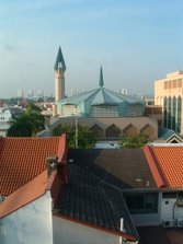
Among the growing band of 3-D modellers flocking to Google Earth is a group of Temasek Polytechnic students who have created a 3-D model of their campus.
Ms Sim Poh Leng, 20; and Mr Ryan Chia and Mr Benjamin Liew, both 19, took six months to finish the job, and the polytechnic now intends to put it to good use.
It wants to let students access courses within the campus using Google Earth.
Mr Oh Chin Lock, a lecturer at the poly's infocomm and IT school, said: 'We might do this within the next six months -- upload YouTube videos of lectures or maybe even a live feed via webcams. Students just need to click on their faculty and view the pop-up video.'
Other schools, like Anglo-Chinese School (Independent), have jumped on the bandwagon, while other modellers have created 3-D representations of attractions like the Singapore Flyer and the route for the F1 race in September.
Even condominium residents have put up models of their blocks -- The Straits Times found at least two, Springdale and Goldenhill Park.
Companies -- from small set-ups to restaurants and hotels -- are also turning to Google Earth to raise their visibility. The firms have added information to their locations on the map.
Clicking on the location for the Pan Pacific Hotel, for instance, brings up a page showing a picture of the hotel, with its address and Web link, as well as reviews.
Since Alenu IT Business Solutions, a small firm in River Valley Road, added its contact details and website address to its location on the map last year, it claims it has gained potential partners and clients 'from all over the world'.
Temasek Polytechnic's Mr Oh thinks property developers can also capitalise on the new trend. 'They can show the plot of land and the 3-D model of their property even before it is built. This will benefit overseas buyers too,' he said.
It is not just businesses that are getting a boost from Google Earth, though.
Two Google Earth Singapore communities have sprung up online -- Earth@sg and SinGeo -- and their numbers are increasing.
The members discuss issues and create new uses for Google Earth and Maps. For example, SinGeo has created a simple animation of dengue hot spots in Singapore, which can be uploaded and viewed on Google Earth.
Earth@sg had 40,000 unique visitors the past month, up from 15,000 in the same period last year. SinGeo has on average 37,200 hits monthly, up from 6,200 last year.
Software developer Jon Petersen, 44, who started SinGeo, said there is another use that has not been tapped yet: tourism.
But to do this, he added, Singaporeans should get on the map quickly. 'We should start putting nice photos, videos, and any other information of our city attractions on Google Earth.'
Subscribe to:
Post Comments (Atom)

No comments:
Post a Comment